About Course
Geospatial Analytics and Climate-Smart Agriculture for Food Systems Resilience Training Course
Introduction
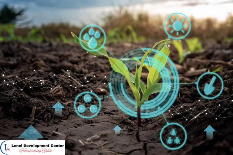
The Geospatial Analytics and Climate-Smart Agriculture for Food Systems Resilience Training Course is a transformative program designed to empower agricultural planners, food security experts, and climate resilience professionals with cutting-edge geospatial tools. Participants will learn to harness remote sensing, GIS, and spatial data analytics to monitor agricultural productivity, forecast risks, and design sustainable interventions that ensure food system resilience in the face of climate change.
With growing threats from droughts, floods, pests, and land degradation, this course provides critical skills in mapping crop health, modeling agri-climatic zones, identifying stress-prone areas, and integrating early warning systems. It equips practitioners with real-time, data-driven insights for smarter agricultural planning and sustainable food production.
Target Audience
- Agricultural Extension and Planning Officers
- Climate Resilience and Food Security Experts
- GIS and Remote Sensing Analysts
- Agronomists and Agri-Tech Entrepreneurs
- Development Partners and NGOs in Food Systems
- Land Use and Environmental Planners
- Researchers and Policy Advisors in Agriculture
Duration
5 Days
Course Objectives
- Understand the principles of climate-smart agriculture and geospatial integration
- Use remote sensing to monitor crop health and land degradation
- Model agri-climatic zones for adaptive planning
- Analyze drought, flood, and pest risks spatially
- Identify hotspots for climate vulnerability in farming systems
- Integrate early warning and food security indicators into GIS
- Optimize land use and cropping patterns using spatial data
- Develop interactive tools for data-driven agricultural resilience
Course Content
Course Content
Module 1: Climate-Smart Agriculture and Spatial Data Foundations
- Climate-smart agriculture principles and objectives
- Importance of spatial thinking in food systems
- Data sources: MODIS, Sentinel, FAO GeoNetwork
- Open-source GIS platforms for agri-monitoring
- Introduction to climate-agriculture nexus
Module 2: Crop Health Monitoring and Yield Estimation
- Vegetation indices: NDVI, EVI, SAVI
- Detecting crop stress and estimating biomass
- Remote sensing-based yield prediction
- Time series analysis for growing season tracking
- Ground truthing and validation methods
Module 3: Mapping Drought, Flood, and Pest Risks
- Drought severity indicators and spatial extent mapping
- Flood risk modeling using DEM and rainfall data
- Pest infestation prediction using weather and vegetation data
- Hazard zonation maps for agriculture
- Integrating multi-risk layers for planning
Module 4: Land Degradation and Soil Productivity Mapping
- Monitoring erosion, salinization, and desertification
- Mapping soil fertility zones and carbon stocks
- Land degradation neutrality (LDN) indicators
- Satellite-based soil moisture estimation
- Assessing land suitability for climate-smart crops
Module 5: Agri-Climatic Zoning and Cropping Calendar Optimization
- Modeling crop suitability under different climate zones
- Building climate-agriculture typologies
- Seasonality and length of growing period mapping
- Rainfall onset and cessation analytics
- Aligning cropping calendars with spatial variability
Module 6: Early Warning and Food Security Surveillance Systems
- Remote sensing indicators for early warning (e.g. VCI, TCI)
- Building food security dashboards
- Forecasting acute food insecurity risks
- Mobile data collection for real-time assessments
- Spatial targeting of emergency response
Module 7: Land Use Planning and Agricultural Adaptation Strategies
- Identifying resilient agricultural zones
- Mapping adaptation interventions (e.g. irrigation, agroforestry)
- Land use conflict analysis
- Multi-criteria evaluation for site selection
- Policy support tools for smart farming
Module 8: Final Project on Climate-Smart Food System Design
- Select a region or country-level case study
- Map agricultural risks using remote sensing
- Develop agri-climatic profiles and cropping zones
- Propose a spatially informed food resilience strategy
- Create and present an integrated GIS-based solution
General remarks
General remarks
- Customizable courses are available to address the specific needs of your organization.
- The participant must be conversant in English
- Participants who successfully complete this course will receive a certificate of completion from Lenol Development Center.
- The course fee for onsite training includes facilitation training materials, tea break and lunch.
- Accommodation and airport pick up are made upon request
- For any inquiries reach us through info@lenoldevelopmentcenter.com or +254 710 314 746
- Payment should be made to our bank